Hazard Assessment
The Hazard Assessment application is the place to analyse your recorded seismic events and evaluate the likelihood of large events and strong ground motions at excavations. The frequency-magnitude distribution of events is quantified throughout the rock mass using a 3D grid-based approach. The likelihood of strong ground motions at excavations is evaluated using the grid sources and a function that relates the peak particle velocity of seismic waves to the event magnitude and distance from the source. The app has various tools to help the user investigate the variation in seismic hazard in space and time and communicate meaningful information to other parties.
This app is intended for experienced engineers familiar with key concepts of mine seismicity, probability and statistics. There are a number of linked resources below to other pages and published literature that explain the important ideas and analysis methods used in this module.
Key Features
- Plot the distribution of seismic hazard throughout the rock mass
- Calculate the ground motion hazard at excavations
- Investigate changes in seismic hazard in mining zones over time
- Rank faults according to observed seismic hazard
- Assess the sensitivity of input parameters on seismic hazard calculations
Supported Data Types
Gallery
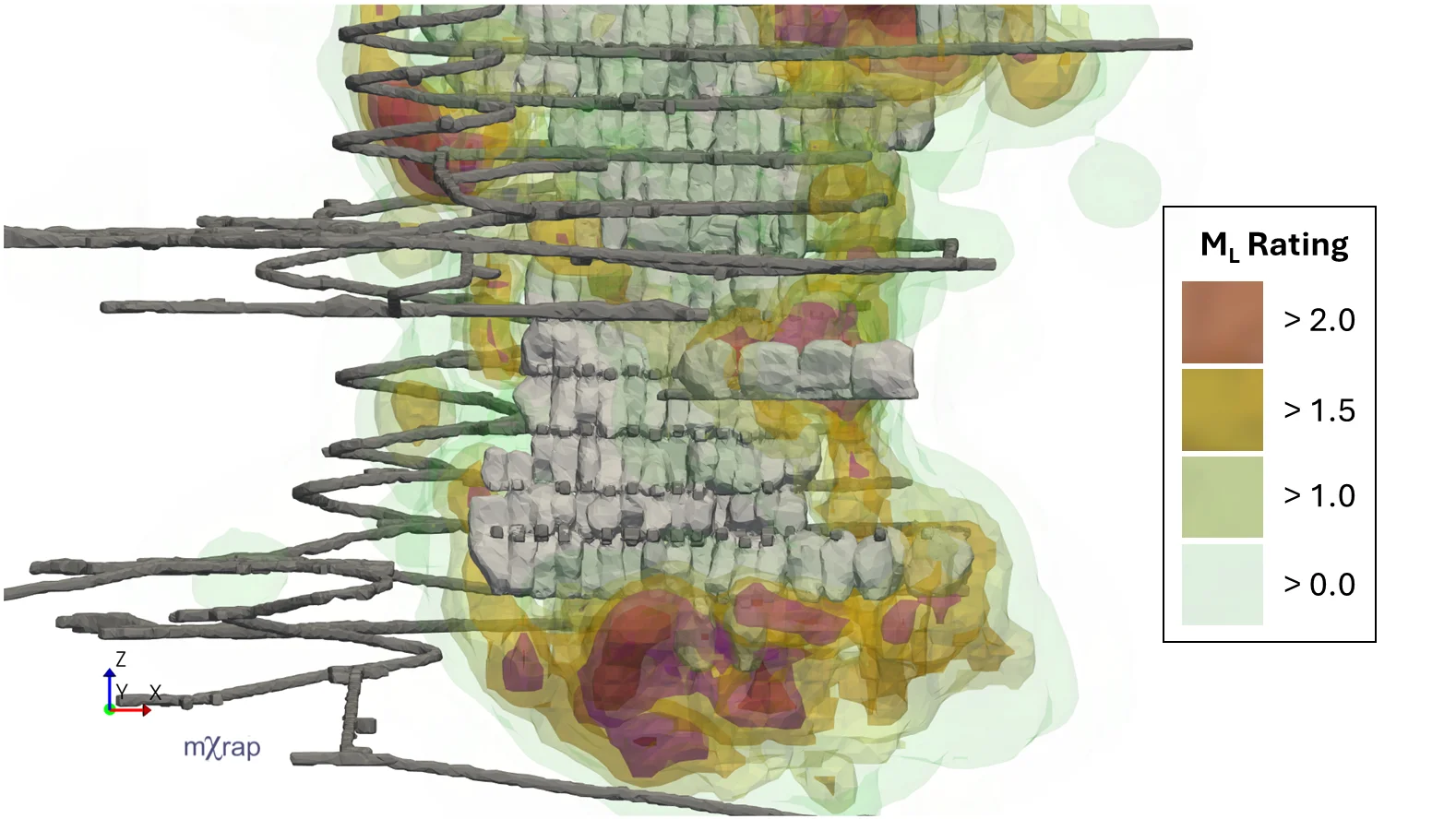
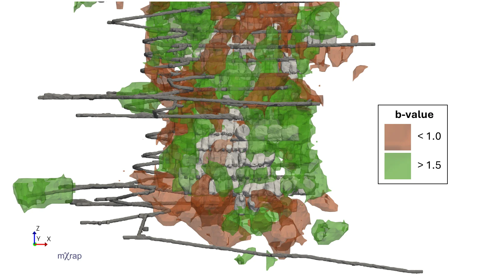
Visualise hazard distribution
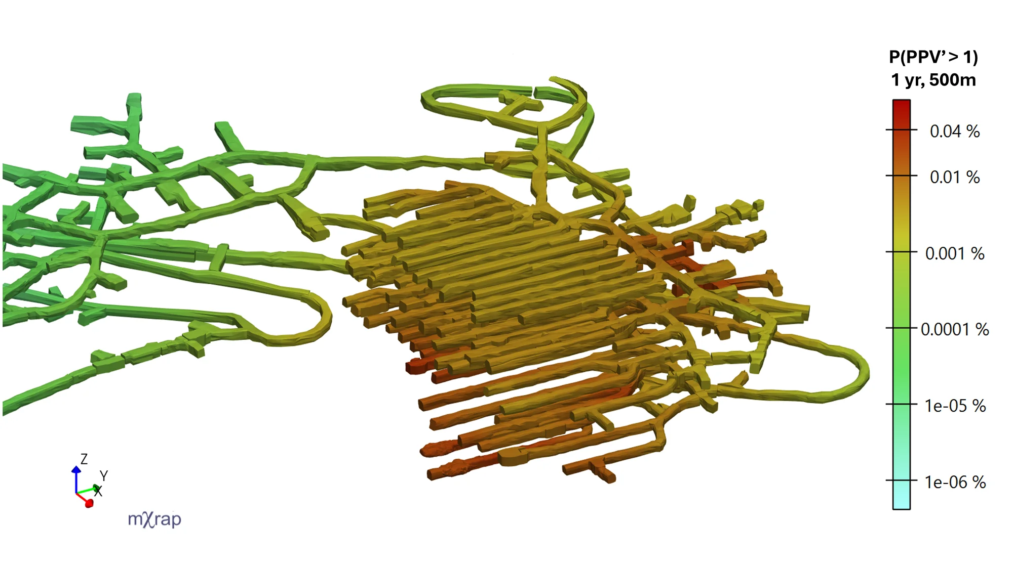
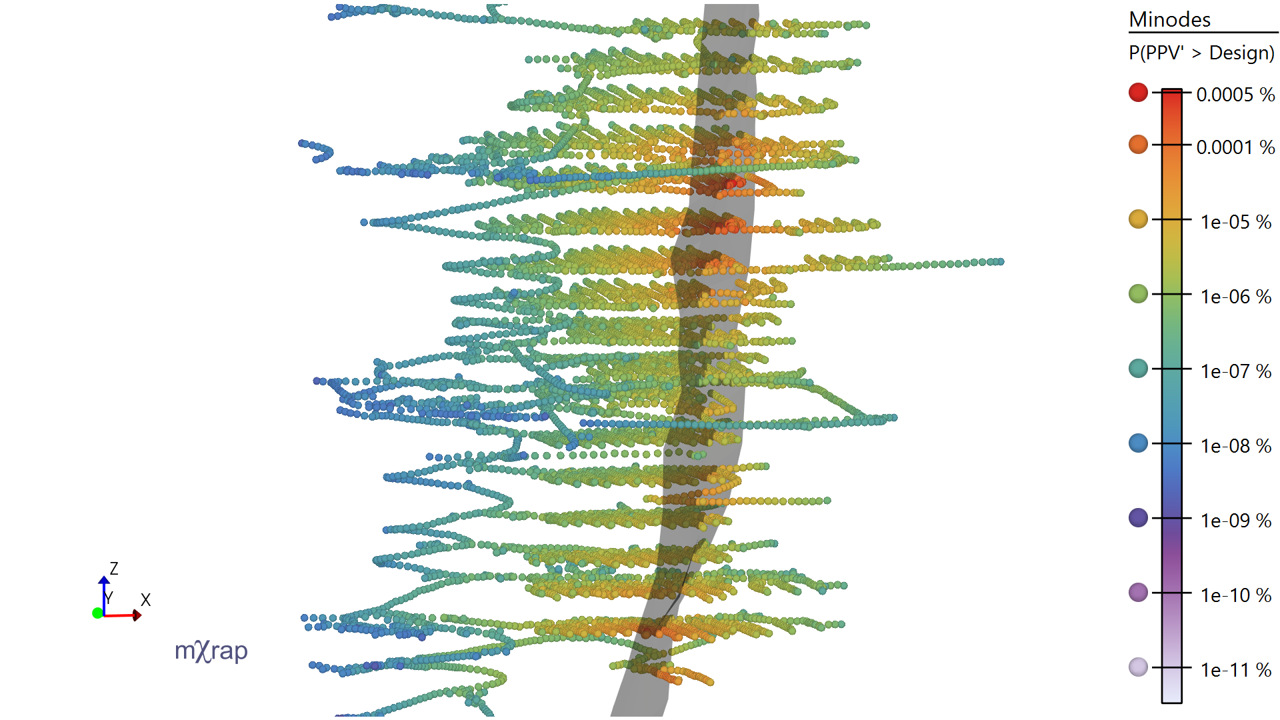
Strong ground motion hazard on excavations
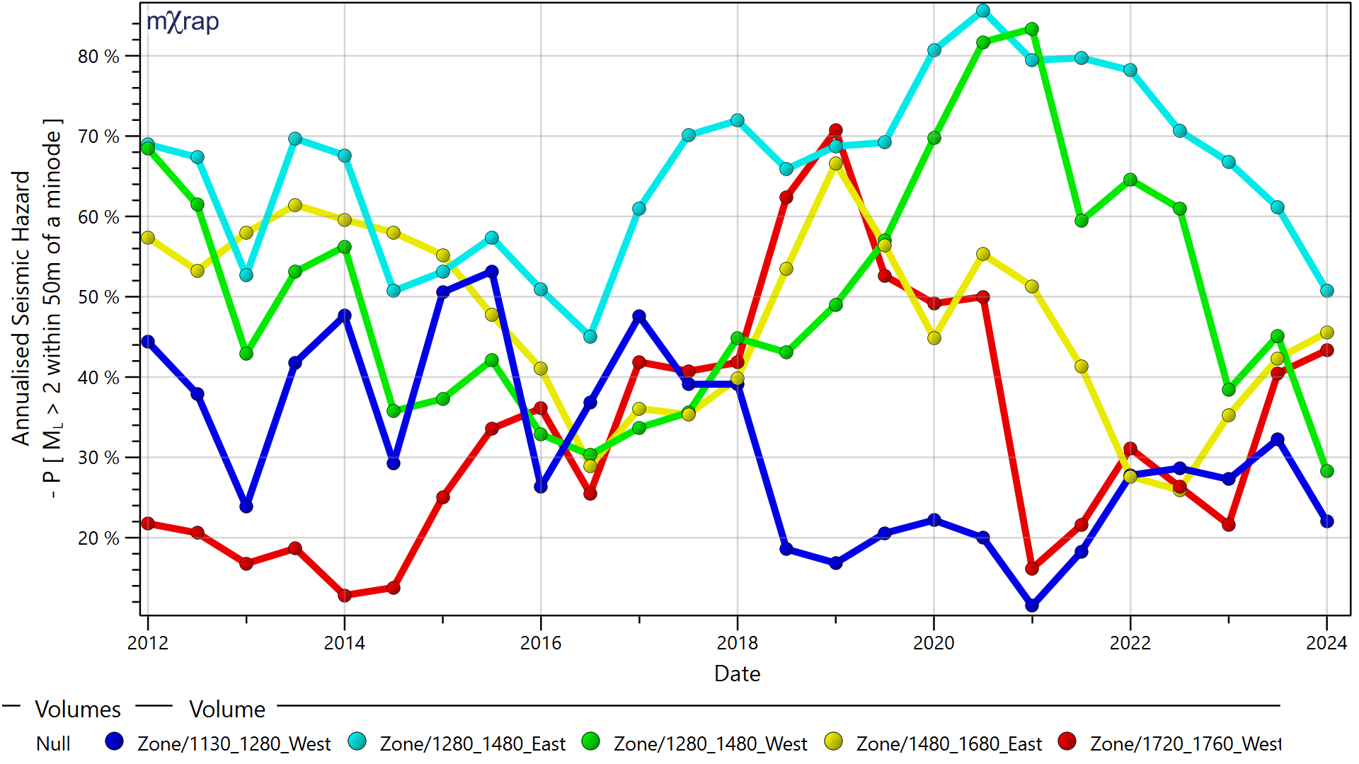
Track seismic hazard in different mining zones over time
Rank faults by hazard they produce on excavations
Plot hazard for chosen fault source
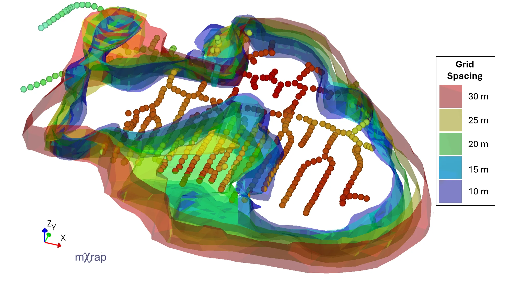
Assess sensitivity of seismic hazard to changes in grid spacing
Demonstration
Documentation
- Hazard Assessment - How to use the app
- Hazard Assessment Theory - How the app works